
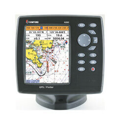
Samyung N-560 Chartplotter – this is a high-precision GPS chartplotter with electronic mapping support NAVIONICSⓡ GOLDideal for small sea and river pleasure and fishing vessels. The device is equipped with a state-of-the-art GPS receiver that provides accurate location information, and can connect to external devices via interfaces NMEA 0183 and NMEA 2000.
Features:
- Color display with an intuitive menu that makes it easy to operate the device.
- NAVIONICS map supportⓡ GOLDproviding up-to-date maps for efficient navigation.
- NMEA 0183 and NMEA 2000 interfaces for connecting external devices and transmitting data to other navigation devices.
- Enabling AIS and NAVTEX to display additional navigation information.To
- Ability to display information about the main engine status via NMEA 2000.
Main Features:
| Characteristic | Meaning |
|---|---|
| Display | 5.6" color TFT display |
| Display Resolution | 480 x 272 pixels |
| Cartography | NAVIONICSⓡ GOLD |
| Interfaces | NMEA 0183, NMEA 2000 |
| Connecting external devices | AIS, NAVTEX, sensors, autopilot |
| Memory | Permanent |
| Keyboard | Silicone with backlight |
| Operating temperature | -10°C to +50°C |
| Storage temperature | -10°C to +50°C |
| Water resistance | Splash protection |
| Power consumption | 350 mA at 13.82 V, 480 mA at 13.82 V max. |
| Power supply | 10-34 vdc |
| Weight | 1600 g |
| Maximum number of waypoints | 10 000 |
| Routes | 100 routes (100 points each) |
Samyung N-560 – it is a reliable and functional chartplotter that is suitable for use on small vessels, providing accurate navigation and integration with other devices on board.
